This is
Hyde Daily Photo Volume 1 (2006-2011) which is now in archive mode. For recent photographs please visit
Hyde Daily Photo Volume 2. Additional material and links to blogger friends can be found at
Hyde DP Xtra.
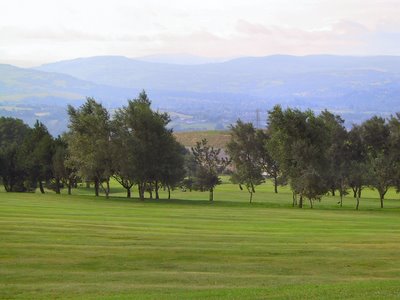
Today's photograph is by Roger May. It first appeared on
Geograph British Isles and is reproduced here with the photographer's permission.
Werneth Low Golf Club occupies part of the area belonging to the Werneth Low Country Park to the west and south of the
Cenotaph.
This view was taken somewhere near to my view over
Godley Reservoir but possibly looking in the opposite direction.
Today's photograph is by Roger May. It first appeared on
Geograph British Isles and is reproduced here with the photographer's permission.
This photograph was taken somewhere near mine of the
River Tame, probably just past the motorway bridge.

Today's photograph is by Roger May. It first appeared on
Geograph British Isles and is reproduced here with the photographer's permission.
Go East from
the end of the M67 and you come to Hollingworth, a village choked by the fumes of traffic on the A628.
It shouldn't be confused with
Hollingworth Lake which is further North near Rochdale.
Today's photograph is by Roger May. It first appeared on
Geograph British Isles and is reproduced here with the photographer's permission.
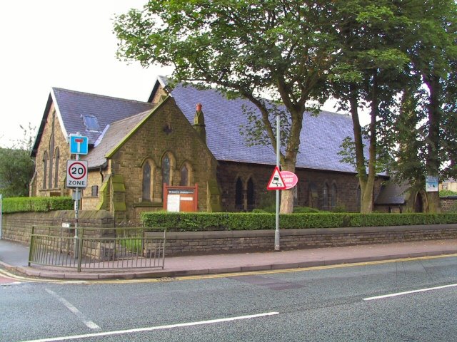
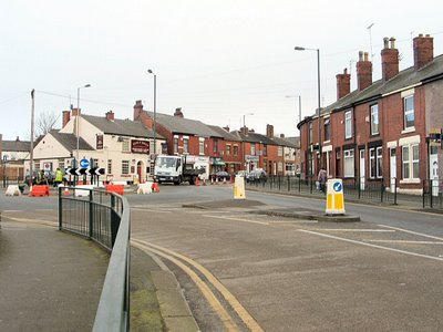
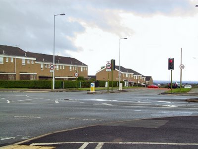
Roger's photograph of this roundabout near the
Ring o' Bells was probably taken about six months before the
James North Clock was erected there.
Today's photograph is by Roger May. It first appeared on
Geograph British Isles and is reproduced here with the photographer's permission.
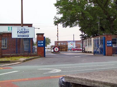
Newton lies mainly to the north-east of Hyde. Newton Business Park occupies 17 acres and provides space for warehousing and light industrial businesses.
Today's photograph is by Roger May. It first appeared on
Geograph British Isles and is reproduced here with the photographer's permission.
Hattersley was built as an overspill estate for Manchester. Its poor reputation wasn't helped by it being home to Ian Brady and Myra Hindley. In the late 70s responsibility for the housing passed from Manchester to Tameside. The home of the Moors Murderers has been demolished. Many of the houses have been bought by sitting tenants whilst the council have passed the rest over to a
Housing Association.

Today's photograph is by Roger May. It first appeared on
Geograph British Isles and is reproduced here with the photographer's permission.
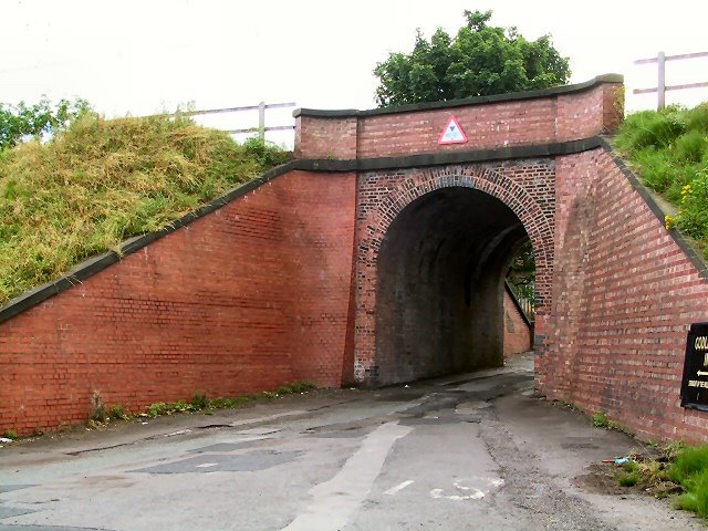
This single arched bridge is under the Glossop to Manchester railway line at the former Godley Junction station (now disused).

Today's photograph is by Roger May. It first appeared on
Geograph British Isles and is reproduced here with the photographer's permission.
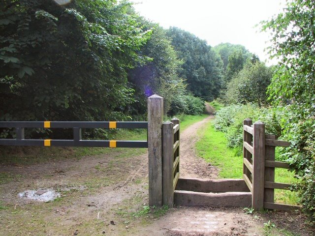
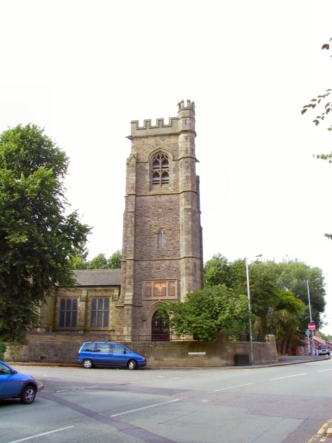
Like
Hyde Chapel, with whom it shares a minister, Flowery Field Church is an independent non-denominational Church affiliated to the General Assembly of Unitarian and Free Christian Churches. It opened in 1878.
Today's photograph is by Roger May. It first appeared on
Geograph British Isles and is reproduced here with the photographer's permission.
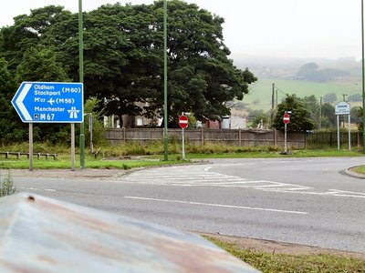
This is the eastern end of the
M67 at Mottram Moor. From here you continue east towards Barnsley or Glossop on the A628 or A57 to Sheffield. A bypass for
Mottram & Tintwistle was approved in 2003 but building work is unlikely to start before 2008!
Today's photograph is by Roger May. It first appeared on
Geograph British Isles and is reproduced here with the photographer's permission.
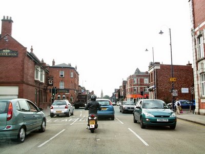
This busy junction on the A57 between Hyde and Manchester has become busier since the recent opening of a new Morrisons superstore {on the left just before these lights} and a retail park about half a mile along the road to the right. Between them they seem to have killed off the smaller traders in the town.
Today's photograph is by Roger May. It first appeared on
Geograph British Isles and is reproduced here with the photographer's permission.
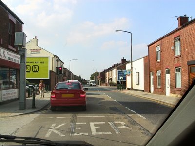
Just past the traffic lights and round the bend on the right
you'll come to
Hyde Mill.
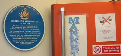
On the wall, right outside of the entrance to the market inside the Clarendon Shopping Centre, is this blue plaque.
It marks the scene of the
Norfolk Arms Disaster

There is usually a charity stall on
Hyde Market each Saturday. The other week instead of selling jumble and bric-a-brac like most charities, this one held a tombola.
Even the dog had a raffle-ticket!
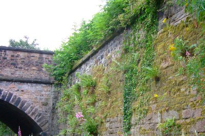
Here we are back on the
Trans Pennine Trail.
This overgrown wall is near the bridge under Stockport Road.

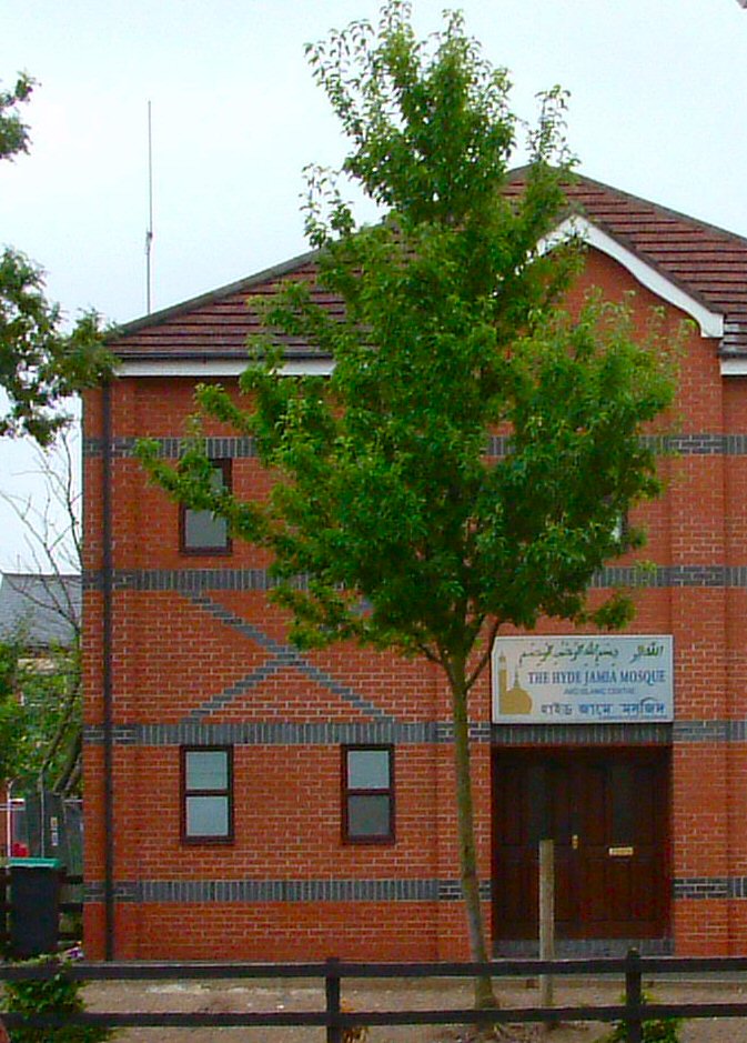
I've shown you a few churches on this site. Now here is a mosque.
This one on Greenfield Street is next door to the
Asda Supermarket

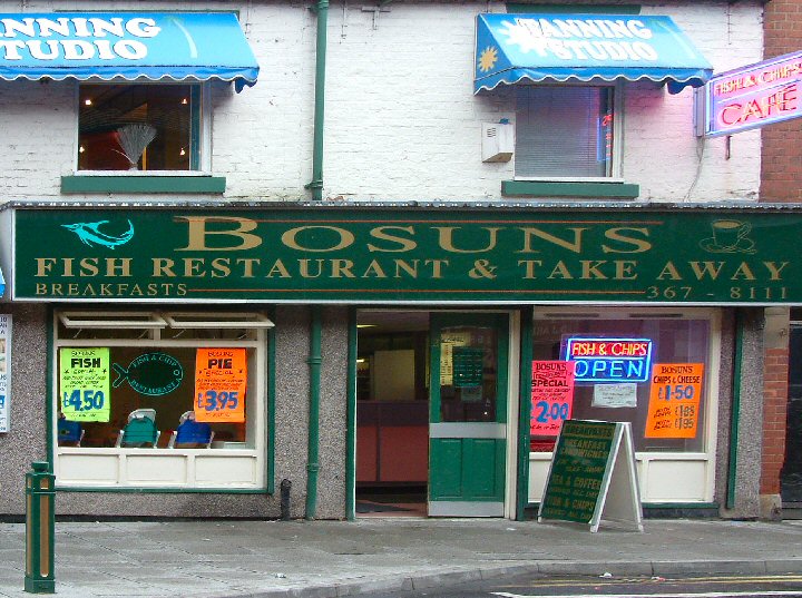
Fancy some fish and chips while in Hyde? Then look no further than
Bosuns. Whilst other cafes in the town seem to have come and gone, this has been here for as long as I've known.
Up until about 11.30 they do breakfast and then they start on the fish and chips. It may be because they chip their own potatoes instead of using frozen ones, or it could be the oil/fat they fry in, but their taste is the best I've ever eaten outside Yorkshire.
They do mushy peas too!

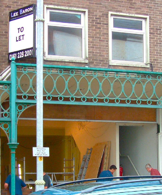
21 Market Street was the address of the surgery run by
Dr. Shipman.
Yesterday morning I saw these workmen at large. It seems the inside of the surgery has been completely dismantled. No doubt the shopfitters will be in next.

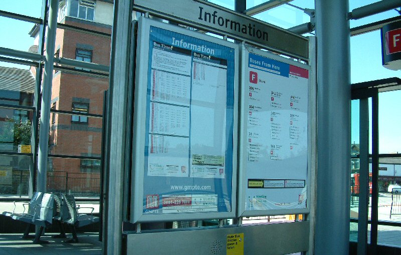
These information boards inside
Hyde Bus Station tell you which services leave from each stand. The left hand panel lists departure times for Weekdays, Saturdays and Sundays giving the time and the service number. The right hand panel shows the service numbers with the destination and some intermediate stops together with the approximate journey time to each point listed.

Follow the road past the
Hare and Hounds and
Ash Tree Farm and you come this viewpoint. It overlooks Audenshaw Reservoir and the M60 Motorway. At night you can see the lights of Greater Manchester and incoming aircraft.

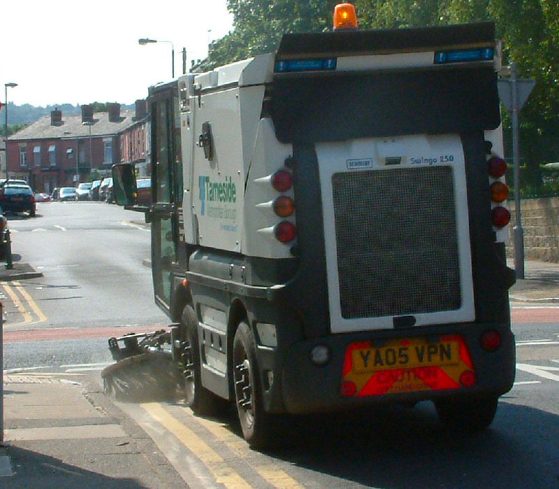
This how they sweep the roads here, well the gutters anyway. I caught this little monster in Henry Street.
Of course it can only clean the pavement edges when they aren't occupied by
parked cars

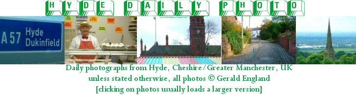
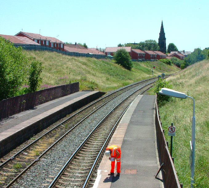
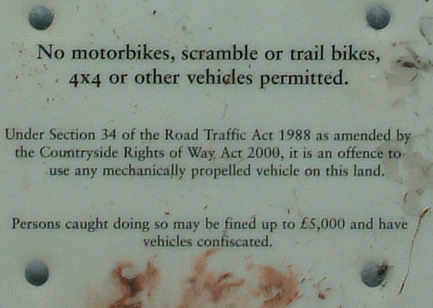
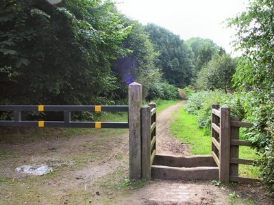
When I last posted a photo of the
disused railway line someone asked where the path started and ended.
Since then I discovered this double-sign. The sign is half-way along an access path that leads to the old railway line which is on the left of the photograph.
It seems the path is part of the
Trans Pennine Trail which stretches all the way from Southport through Liverpool to Hull and Hornsea.


Hyde has a lot of public houses; I've displayed only a handfull on these pages, yet quite a few old pubs no longer exist.
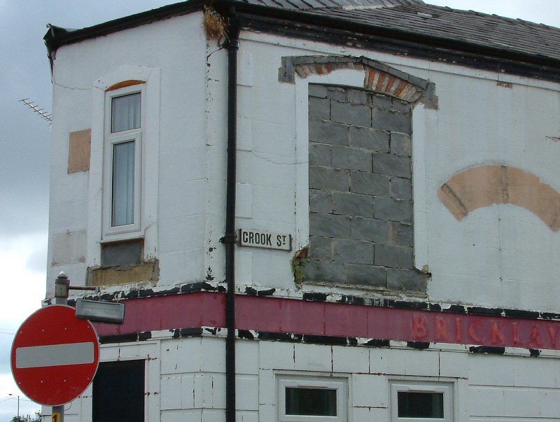
The
Bricklayers Arms at the bottom of Crook Street is one of the latest casualties. I think it is going to be converted into a residential property.
It does have some residents already; there's a birds nest at the top of the drainpipe.
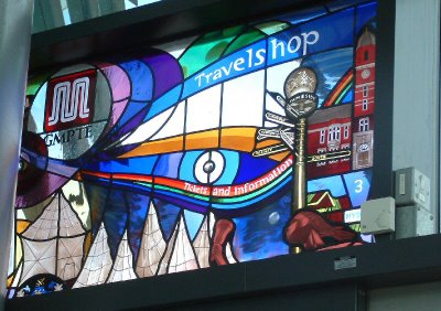
I recently posted a picture of one of the
Stained Glass Panels in Hyde Bus Sation.
Here is the second one. It was more difficult to get a good shot of this one as part of it is hidden behind a pipe.
GMPTE stands for Great Manchester Passenger Transport Executive. They recently scooped
Passenger Transport Authority of the Year.

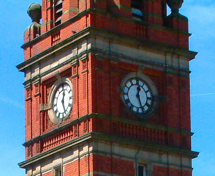
I like the clock on Hyde Town Hall, mostly because I see it frequently and I find its familiarity friendly.
It may lack the elegance of the one on the courthouse in
Kuala Lumpur or the incomparability of the steam clock in
Vancouver but I love it just the same.

This is the view from my bedroom window -- over the rooftops to St. George's Church and East Manchester. Sometimes it is easy to see the City of Manchester Stadium, built for the Commenwealth Games and now home to Manchester City FC. If I look hard enough I can often make out the
B of the Bang.
On a really clear day the TV mast on Winter Hill, 30 miles away, becomes visible.

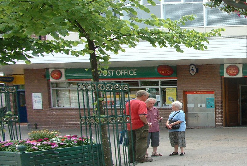
I posted a picture of the old
Post Office some while back.
Here is the new one. It can be a bit cramped and when busy the queues often stretch through the door. Most of our old local P.O.s have been closed down so you have to come into town to buy your stamps.
In nearby Ashton there is uproar over plans to close the town's well loved Post Office and move the operation into W.H.Smiths.

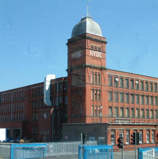
Hyde Mill off Ashton Road in Newton was for a long time the
Senior Service cigarette factory. You could smell the tobacco in the air anywhere within about a mile radius.
Now it is home to an educational stationery supplier.
Not so long ago it was the scene of an accident when a floor collapsed in one of the new buildings on the site. There was a meeting going on at the time. Who were at the meeting? Local Health & Safety Officers!

This view is taken from Werneth Low Road, a short way past the
Hare and Hounds, where Cowlishaw Road turns off to go down a steep winding hill to Compstall.

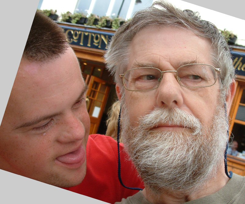
The theme among the Daily Photo fraternity today is a self-portrait in a favourite place.
I got someone to take a photo a few weeks ago but it was totally out of focus. This Saturday I tried taking one by holding the camera at arms length and shooting.
So here I am on a bench outside the
Cotton Bale with my son
Craig. I've only been in the
Cotton Bale once, with Craig and his mum. They served a nice meal but it was a bit too crowded and noisy. However we understand Craig likes going there with his friends to eat.
Before you all comment, I should add that I've since visited the barber and had my beard trimmed!
To view the other self-portraits of DP bloggers, choose one these numbers:
1 -
2 -
3 -
4 -
5 -
6 -
7 -
8 -
9 -
10 -
11 -
12 -
13 -
14 -
15 -
16 -
17 -
18 -
19 -
20 -
21 -
22 -
23 -
24 -
25 -
26 -
27
Unless otherwise stated, all photographs on this site are copyright © 2006, 2007, 2008, 2009, 2010, 2011 Gerald England.
In most cases, clicking on the photograph will reveal a larger-sized image.