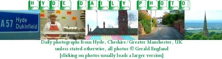
This is
Hyde Daily Photo Volume 1 (2006-2011) which is now in archive mode. For recent photographs please visit
Hyde Daily Photo Volume 2. Additional material and links to blogger friends can be found at
Hyde DP Xtra.
The time has come to vote for the best of Hyde DP 2012.
View the twelve contenders at
Best of Hyde 2012 and vote for your favourite three photographs.
Voting closes 12 noon GMT, 28th December 2012.

The time has come to vote for the best of Hyde DP 2011.
View the twelve contenders at
Best of Hyde 2011 and vote for your favourite three photographs.
Voting closes 12 noon GMT, Friday 30th December 2011.

Shadows fall across the A560 on a sunny morning a few weeks ago.
Across the road is a boundary stone marking the entrance to Hattersley.
A close-up of the stone can be found on
Hyde DP Xtra.
For more shadow shots visit
Hey Harriet.

Now that some of the houses on Moorside Place are occupied, the new road open and the fence by the towpath removed, the view of the bend in the Peak Forest Canal has been opened up.
Compare it with the views in

A look up Dukinfield Road from the end of Throstle Bank Street during a brief spell of sunny weather last Saturday afternoon.
The road is the A627 leading to Ashton under Lyne.
The long row of houses on the left date from 1880.
For more sky shots visit
Skywatch Friday.

This part of Dowson Road from the corner of Markland Street down to Market Street was originally
Swain Street before the road was extended in the 1930s bypassing the village of Gee Cross.
The sign on the lamppost says "For Hyde United follow Tameside Leisure Park" despite the fact that Hyde United is simply
Hyde FC now.

Under the tarmac of Clarendon Place lie the cobblestones of
Hoviley Brow.

Looking down
Nelson Street coming from Market Street.
Travis Street goes off to the left. Nelson Street continues to the right then takes a sharp left to join
Ridling Lane. That dog-leg section carrying one-way traffic between Ridling Lane and Travis Street is marked on some street maps and GoogleMaps as a continuation of "Travis Street" despite the clear streetname signs.
I don't know for sure but would suspect that the gap now occupied by a secure garage or store room was originally a corner shop.
Lumn Hollow is, I think, the site of
The Lumn. Long demolished it was the oldest house in Hyde.
An old text quoted on
Hyde Cheshire states
a lane led to Walker Fold Lane, down Lumn Hollow, where an ancient bridle path, passed by Lumn Farm, then branched off, and then it became Ridling Lane, until it joined Hoviley Lane at Ridling pits (on the site of Queen's Hotel, Clarendon Place).
The semi-detached houses you can see here are on Ridling Lane. Some years ago Victorian terraced houses lined both sides.
In the background is a block of flats called
Chartist House.
For the coloured version of this photograph see
Geograph.

Looking up Clarendon Road from just past
the viaduct.
The Police Station is just past the big tree on the left.

Marlborough Road, Gee Cross is a typical street of post-war semi-detached houses. The view here is from the corner of Gloucester Road near Dowson Primary School.

A terraced street leading off Mottram Road. The M67 motorway is at the bottom end behind the fence. On the left is the car park for Morrisons supermarket but there is no entry/exit to/from it off Brook Street.

Henry Street used to be what is known as a
"rat-run".
To deter motorists using it as a shortcut to and from Dowson Road, some roads in the area were made one-way in a confusing rather than straightforward way.
Here at the corner with Church Street the roadway width was reduced to prevent HGVs from using the road.
On the right is part of St George's Church of England Primary School.
From tomorrow I'll be away on holiday. In the meantime Rune from
Visual Norway will be minding the blog for me. I have scheduled some special posts for the period taking readers on day trips to the West.

Before the demolition of James North and the building of an estate of new houses, this was Queen Street.
Now it is a continuation of Douglas Street, the other end of which I showed you in my post of
August 16th 2010.
This end adjoining Lumn Road is similarly blocked off by bollards.
You can see photos of Douglas Street/Queen Street and how it used to look on Nancy & Tom's
Hyde, Cheshire.

James North's was a multi-national safety apparatus and clothing manufacturer who operated out of a huge cotton mill in Hyde. The firm patented the PVC glove in 1947 and they were commissioned to make gauntlet gloves for Sir Ernest Shackleton’s great Antarctic expedition.
The firm closed down and Slack Mill was demolished in 1998. An estate of houses was built on the site. In 2006 the clock from the top of the mill tower was re-erected on this
mini-roundabout. The road into the estate is called
James Drive and the houses on the left are in Clock Tower Close.
An old image of Slack Mill can be found on
Old Hyde.
More information about James North's can be found on
Hyde Cheshire.
For more J posts visit
ABC Wednesday.

I always thought this was the corner of Lumn Road and Stockport Road but as an old photograph on
Hyde Cheshire attests, it is actually Back Lane.
Unless otherwise stated, all photographs on this site are copyright © 2006, 2007, 2008, 2009, 2010, 2011 Gerald England.
In most cases, clicking on the photograph will reveal a larger-sized image.